Brownfield Site Geophysical Surveys
Reducing the risks of redevelopment
The redevelopment of brownfield land is a challenging process, with pipelines, abandoned storage tanks, contaminated waste deposits and remnants of earlier engineering structures all among the possible hazards underground.
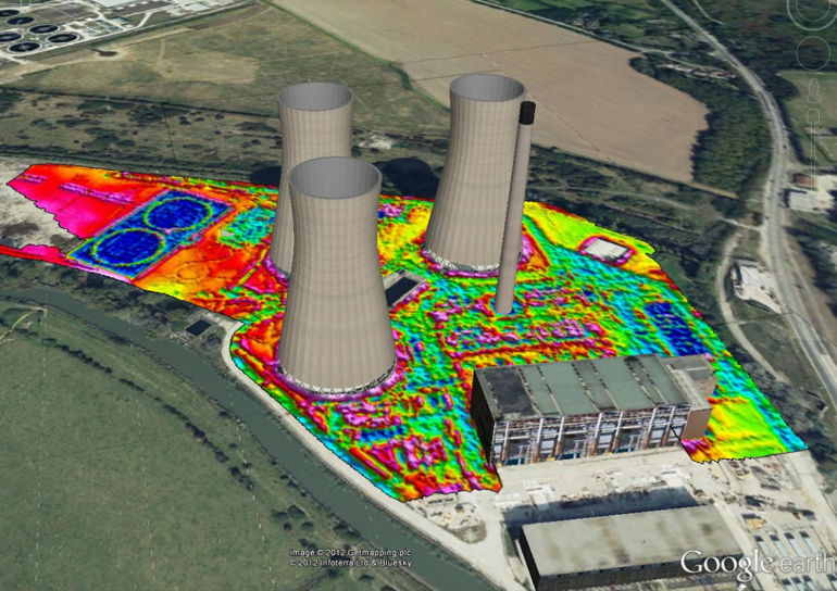
In such a potentially complex burial setting, targets can be difficult to detect, so at Zetica, we adopt an integrated approach to mapping – typically combining two or more different geophysical survey methods to help us better characterise the subsurface.
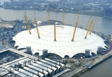
It’s an approach that has yielded some excellent results for notable clients, including the O2 Arena in Greenwich – where we conducted a detailed geophysical survey to map in-ground obstructions and hazards prior to earthworks commencing.
Other examples of our work on Brownfield sites include:
- Locating underground storage tanks
- Locating buried pits and foundations
- Locating buried utilities
- Detecting unexploded ordnance
- Mapping bedrock depths
- Mapping groundwater surface and flow paths
- Mapping depth to clay aquitard
For advice on your Brownfield development project…
To discuss your Brownfield project with one of our geophysical engineers or to get an estimate for our services, please just call (0)1993 886 682 or contact us online.