Fault Zones and Voids
Global experts at finding faults
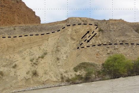
Accurate mapping of geological faults, voids and highly weathered zones is critical for successful foundation design – and Zetica’s unobtrusive surveys provide the detailed ground profile you need to design and build with confidence.
We can help characterise overburden soil stiffness, as well as mapping faulting or large voids in the underlying geology that can be a source of relative movement, preferential groundwater flowpaths and differential settlement.
Our surveys can also help you understand the risk of soil liquefaction in earthquake-prone areas – providing a more thorough understanding of ground conditions than can be achieved by traditional, intrusive techniques.
That’s why we’re trusted by large consultancies around the world to inform the design of major structures – often on the most complex and challenging geology.
Our approach
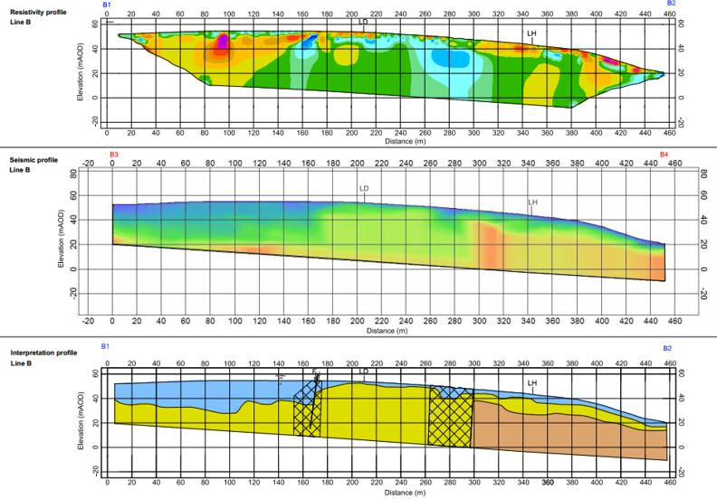
Here at Zetica, we recognise that detailed survey design is key, so significant forward planning and modelling is undertaken to ensure the proposed techniques are appropriate for the anticipated site conditions.
We use a number of different survey techniques and technologies to provide high resolution at different depths, often combining techniques to deliver a clear picture of both shallow and deep ground.
All our data processing is overseen by PhD level senior geophysicists, with geotechnical engineers on hand to provide interpretative reporting, providing results that always make sense.
Find out more…
To find out more about how we can help you detect fault zones and voids, please just give us a call on (0)1993 886 682 and speak to one of our geophysical engineers. Alternatively, you can contact us online.