ZeticaRoad Surveys
Non-intrusive and non-disruptive road surveys
Up until 2020, the average person in the UK took around 600 journeys by car per year either as a driver or passenger meaning a road network is perhaps the most visible and therefore publicly scrutinised national or regional asset. Most people do not have to travel more than a mile before having to negotiate a road in a visible state of disrepair, not to mention areas where defects are forming out of sight beneath the surface.
Road works and closures can be disruptive to journey times so the more that can be accomplished without them, the better.
Routine and early-stage investigative surveys to identify distress and to update construction information can save on costs and disruption by identifying problems early when maintenance options are easier, more effective and less disruptive.
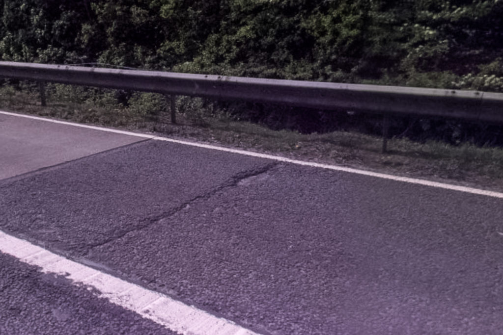
Transverse crack and pot hole
Why choose Zetica for road surveys?
Zetica have been a provider of non-intrusive road surveys using ground penetrating radar (GPR) for nearly three decades though ZeticaRoad is a new name for Zetica’s highway pavement infrastructure survey capability. The initiative is led by a dedicated Technical Manager with over 20 years of experience in the highways sector.
At ZeticaRoad we believe that road surveys should be carried out as close to the prevailing traffic speed as possible, without significant impact on other road users.
In addition to GPR, our specialist survey vehicles can be equipped with high resolution panoramic and linescan camera systems and mobile laser scanning technology. Together these systems provide comprehensive surface and subsurface information on pavement condition.
We are experts in utilising data from multiple sources and providing a complete evidence-based approach to reporting the condition of a road. We can integrate our data with complementary information from industry partners including deflection data, invasive testing such as coring, and national surveys of pavement condition e.g. TRACS, SCANNER, TRASS, or SCRIM.
Our RASC viewer software platform allows our customers to see the data for themselves, quickly and easily to provide the utmost confidence in locating problem areas.
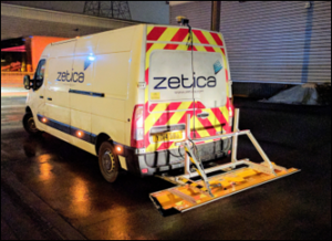
Dense array GPR antenna ready for survey
Our road survey services at a glance…
- Map construction changes, joints and pavement-layer thicknesses
- Map rebar, tie bars and dowel bars including alignment and depth
- Detect voids and delamination in pavements and bridge decks
- Detect concentrations of moisture
- Provide high resolution images of the pavement for visual condition surveys or road asset capture
Keen to find out more?
To discuss road surveys with one of our experts or to get an estimate for our services, please call (0)1993 886 682, email roads@zetica.com or contact us online.